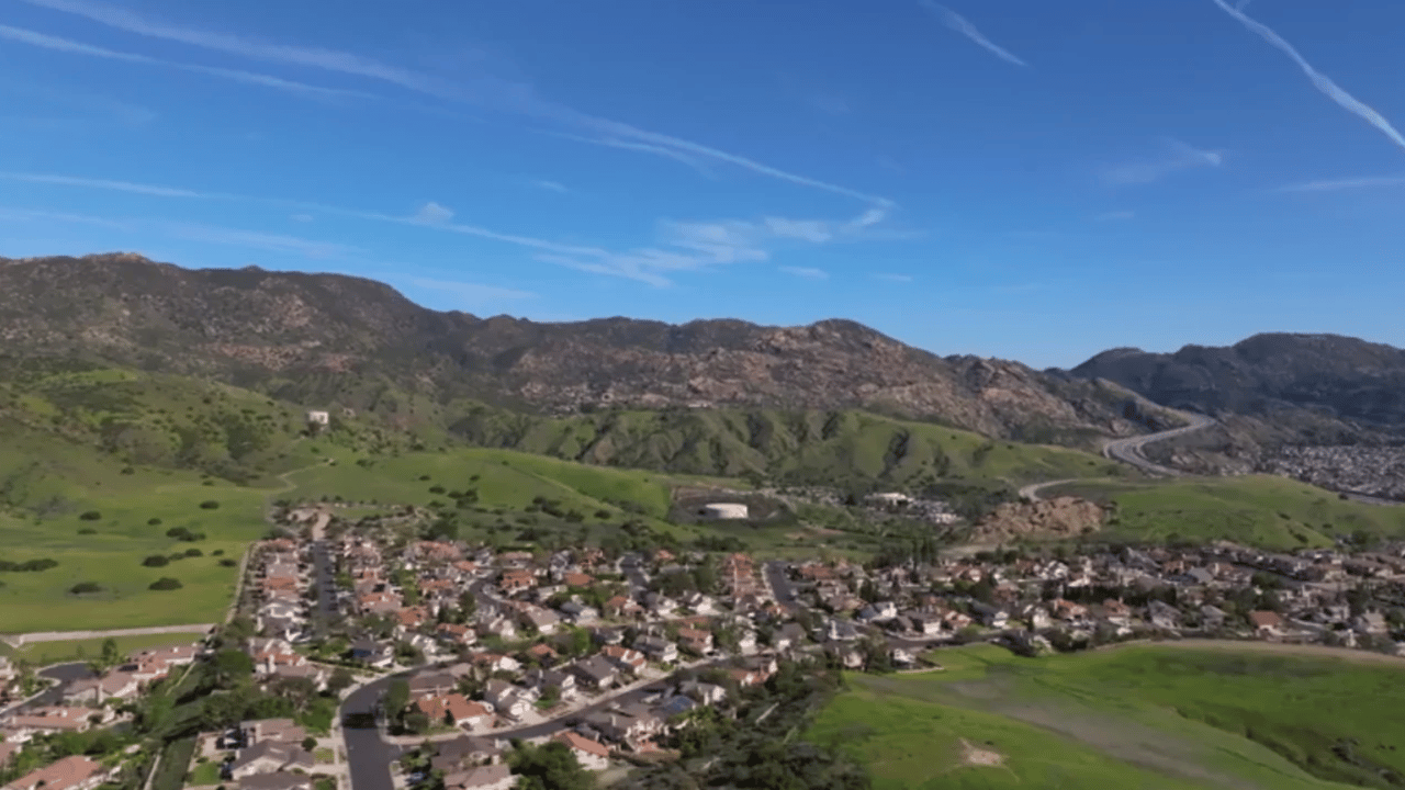
The 101 at Liberty Canyon Road carries more than 300,000 cars a day. Over those ten lanes of pavement there is now a planted span 250 feet long and 174 feet wide, plus a second, smaller span over Agoura Road. According to its builders, the Wallis Annenberg Wildlife Crossing opens "for the animal world on December 2, 2026."
The phrase "for the animal world" matters, because no person will walk across it on opening day or after. The design leaves people off the bridge on purpose. Residents who have driven under it since construction began in 2022 can see it in three ways. They can watch the ribbon-cutting on a screen in Calabasas, book a guided climb to a lookout on the south side, or follow the data scientists start collecting once animals begin to cross.
A bridge built without a single trail
The crossing's official FAQ says plainly that it has no trails and no public access. The community supported giving wildlife "every opportunity for safe passage" during public engagement. The same FAQ says people will be able to see the crossing from recreation trails in the area and that a viewing platform will be built.
The size follows the same logic. The project counts the 101 span at 43,500 square feet and the Agoura Road span at 12,425 square feet, for 55,925 square feet combined. The full site covers nearly 13 acres. For comparison, the FAQ lists Colorado's I-25 Greenland overpass at 41,800 square feet. The builders explain the difference with crossing science: the longer a crossing has to run, the wider it needs to be for animals to treat it as habitat. On top, the 101 span carries nearly an acre of native vegetation.
There was also no choice about where to put it. The FAQ says Liberty Canyon holds the last 1,600 feet in the area with protected land on both sides of the freeway. Beth Pratt, who leads the National Wildlife Federation's #SaveLACougars campaign, put it this way in an October update reported by the Acorn: "We had the site picked for us."
According to the Acorn, the cost now stands at $114 million, 23% above the original construction estimate of $92.6 million.
Opening day happens on a big screen at King Gillette Ranch
Since the public can't go on the bridge, the public ceremony is held elsewhere. The ribbon-cutting at the crossing itself will be streamed live, and the public festival takes place about a canyon away.
| Detail | Public Ribbon-Cutting & P-22 Legacy Celebration |
|---|---|
| Date | Wednesday, December 2, 2026 |
| Place | King Gillette Ranch, 26800 Mulholland Hwy, Calabasas |
| Hours | 11:30 a.m. to 3:30 p.m. |
| Entry | Tickets required; $10 donation for ages 13 and up, $5 for ages 12 and under |
| On site | Partner exhibits, music, special guests, the crossing ribbon-cutting shown live on a large screen, and a virtual ribbon guests can cut themselves |
| Weather | Held rain or shine; no cancellations or refunds |
Ticket donations go to the National Wildlife Federation's #SaveLACougars campaign. Schools and other groups may qualify for group pricing or scholarships through the event page. ABC7 reported that the day also launches a partnership between the National Wildlife Federation and the Wildlife Crossing Fund. The partnership will support long-term research and native habitat restoration at the crossing, along with connectivity projects elsewhere.
The festival is the main public event of the day, but it's held miles from the bridge. To see the crossing in person, residents have to take a guided tour to the lookout.
The closest a person gets is a hilltop on the south side
The National Wildlife Federation runs free docent tours that last about 50 minutes and require a reservation. Guides cover local wildlife, how the crossing was designed, and the habitat restoration around it. The tour page currently says tours are on a brief hiatus. The booking form shows dates as they become available and describes the tours as year-round.
How the tours work, per the reservation form:
- Every tour is on the south side, up a short, steep, unfinished trail to a hilltop lookout.
- The south side gives the better view; the form calls the north-side view very limited.
- Individual bookings are capped at two adults. Groups of eight or more book by email.
- Every attendee signs a waiver.
- Parking is free but limited, in a designated lot on Agoura Road. Lot details arrive by email after booking.
- Tour details can change with weather and flooding.
The form also says tours will continue after the crossing opens, and that neither tour groups nor the public will walk on the crossing. Even after December 2, the hilltop lookout is as close as the public gets.
December 2 marks the start, and some of the work comes after
According to the Acorn's October 16 report, the bridge structures and utility relocations are finished, and a major water line has been rerouted. Crews are now building large earthen mounds along both sides of the crossing. The mounds will rise above the level of the 101 and help shield animals from the sight and sound of traffic. Pratt told the paper that much of the habitat restoration will happen after opening. She also said the vegetation already planted over the freeway is "flourishing" and drawing hummingbirds, native bees, butterflies, western fence lizards and raptors.
The schedule's main risk is weather. The project was originally slated for completion in 2025, and the crossing's FAQ says record precipitation and flooding slowed progress for two springs in a row. The Acorn reported that the 2022 and 2023 flooding disrupted soil compaction, and some of the remaining work is that same kind of soil work. Pratt told the Acorn:
"So this is the first time in my history as a Californian that I am praying for no rain, at least until (after) Dec. 2, or at least no flooding events."
The paper noted that the forecast calls for a potentially historic El Niño through early 2027. Pratt said weather experts expect the heavier rain to arrive after the planned opening, and erosion-control measures were already in place.
The animals decide when it really opens
The crossing does its job once animals start using it. Pratt told the Acorn that coyotes are the favorites to cross first, since they have been coming up to the construction site every day. National Park Service cameras have also recorded deer, bobcats and foxes near the site.
The research plan tracks more than whether animals cross. Seth Riley, a National Park Service wildlife ecologist, told the Acorn that scientists will fit deer north and south of the freeway with radio collars. They plan to use body sensors on deer, and possibly mountain lions, to record heart rate, temperature and activity. "Are they happy to go up on there, and their heart rate doesn't change?" Riley asked.
The mountain lions are the reason the crossing exists. The goal is to raise genetic diversity by letting isolated groups in the Simi Hills and the Santa Monica Mountains meet and breed. NPS biologist Jeff Sikich told the Acorn that nine lions are currently tracked across the Santa Monica Mountains, Simi Hills and Santa Susana Mountains. A new litter was recently found in the Simi Hills, born to a female of about 3 years old known as P-13. Researchers marked one male and two female kittens when they were about 3 weeks old. Sikich said the kittens could be among the first mountain lions to use the crossing once they leave their mother at roughly 18 months. That puts their first chance to cross around 2028, long after the festival on December 2.
Driving past it between now and then
The City of Agoura Hills canceled the Liberty Canyon Road ramp closures it had planned for October 30, which would have shut the northbound on-ramp and the southbound off-ramp. The city reported Agoura Road open to through traffic, though intermittent closures may be needed as work continues. The project FAQ says no full freeway closures are expected, but it allows for occasional nighttime closures in one direction between midnight and 5 a.m. Caltrans posts current closures through its QuickMap service and keeps project information on its District 7 crossing page.
On the drive under the 101 span, the new mounds of earth on both sides belong to the work still underway. Their job is to block the view of the traffic below.
Projects like the Liberty Canyon crossing change how the stretch between Agoura Road and the Simi Hills looks and works. The Dingman Group tracks changes like this across Agoura Hills and the Conejo Valley. If you own a home near the crossing and would like to know how your property compares today, we're glad to start with a free home valuation.